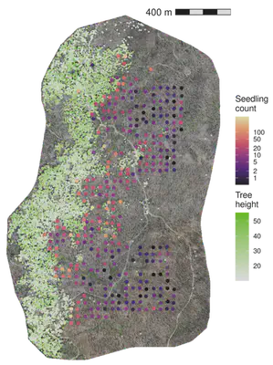
Post-fire conifer seed dispersal
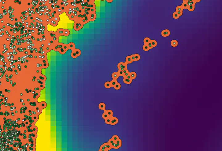
We are using drone-derived maps of individual surviving trees to improve predictions of post-fire forest regeneration. We are mapping thousands of surviving trees and surveying conifer regeneration density in hundreds of field plots. We are using nonlinear Bayesian models to estimate tree dispersal kernels based on the summed contribution of each tree to the regeneration in each field plot. The models allow us to simultaneously estimate the dispersal kernel parameters and the summed contribution of each tree to each field plot.